


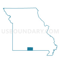
Dawt Voting District, Ozark County, Missouri
About
Outline

Summary
| Unique Area Identifier | 609296 |
| Name | Dawt Voting District |
| County | Ozark County |
| State | Missouri |
| Area (square miles) | 26.15 |
| Land Area (square miles) | 25.86 |
| Water Area (square miles) | 0.29 |
| % of Land Area | 98.89 |
| % of Water Area | 1.11 |
| Latitude of the Internal Point | 36.59366520 |
| Longtitude of the Internal Point | -92.27378720 |
Maps


Graphs
Select a template below for downloading or customizing gragh for Dawt Voting District, Ozark County, Missouri


Neighbors
Neighoring Voting District (by Name) Neighboring Voting District on the Map
- Bayou I Voting District, Ozark County, MO
- Bridges Voting District, Ozark County, MO
- Lick Creek Voting District, Ozark County, MO
- Richland Voting District, Ozark County, MO
Top 10 Neighboring County Subdivision (by Population) Neighboring County Subdivision on the Map
- Bridges township, Ozark County, MO (968)
- Bayou I township, Ozark County, MO (917)
- Richland township, Ozark County, MO (794)
- Dawt township, Ozark County, MO (492)
- Bayou II township, Ozark County, MO (466)
- Pine Creek township, Ozark County, MO (439)
- Lick Creek township, Ozark County, MO (434)
Top 10 Neighboring Unified School District (by Population) Neighboring Unified School District on the Map
- Gainesville R-V School District, MO (4,526)
- Dora R-III School District, MO (1,843)
- Bakersfield R-IV School District, MO (1,706)